Like most ultras, the Bhutan Ultra is more than just a race – it’s a journey. In the Land of the Thunder Dragon, every step before the start line is part of the adventure. You won’t just acclimatize to altitude – you’ll immerse yourself in a culture, a landscape, and a rhythm unlike anywhere else on Earth.
If you join us for the long itinerary (17 days), this is what we have in store for you:
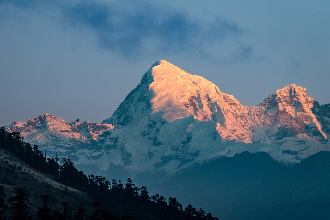
November 11th, arrival – Paro (2,400 m)
Your adventure begins with one of the most spectacular landings in the world – grab a window seat! As you descend into Paro, you’ll immediately feel that this is no ordinary race destination. You will arrive at one of the world’s most beautiful airports and right away get a first tase of Bhutanese hospitality – warm, genuine, and unforgettable.
Apart from that, it will be a “quiet” day. We’ll go on a tour of Paro and give you the chance to settle in.
November 12th, Tiger’s Nest – your first test (3,120 m)
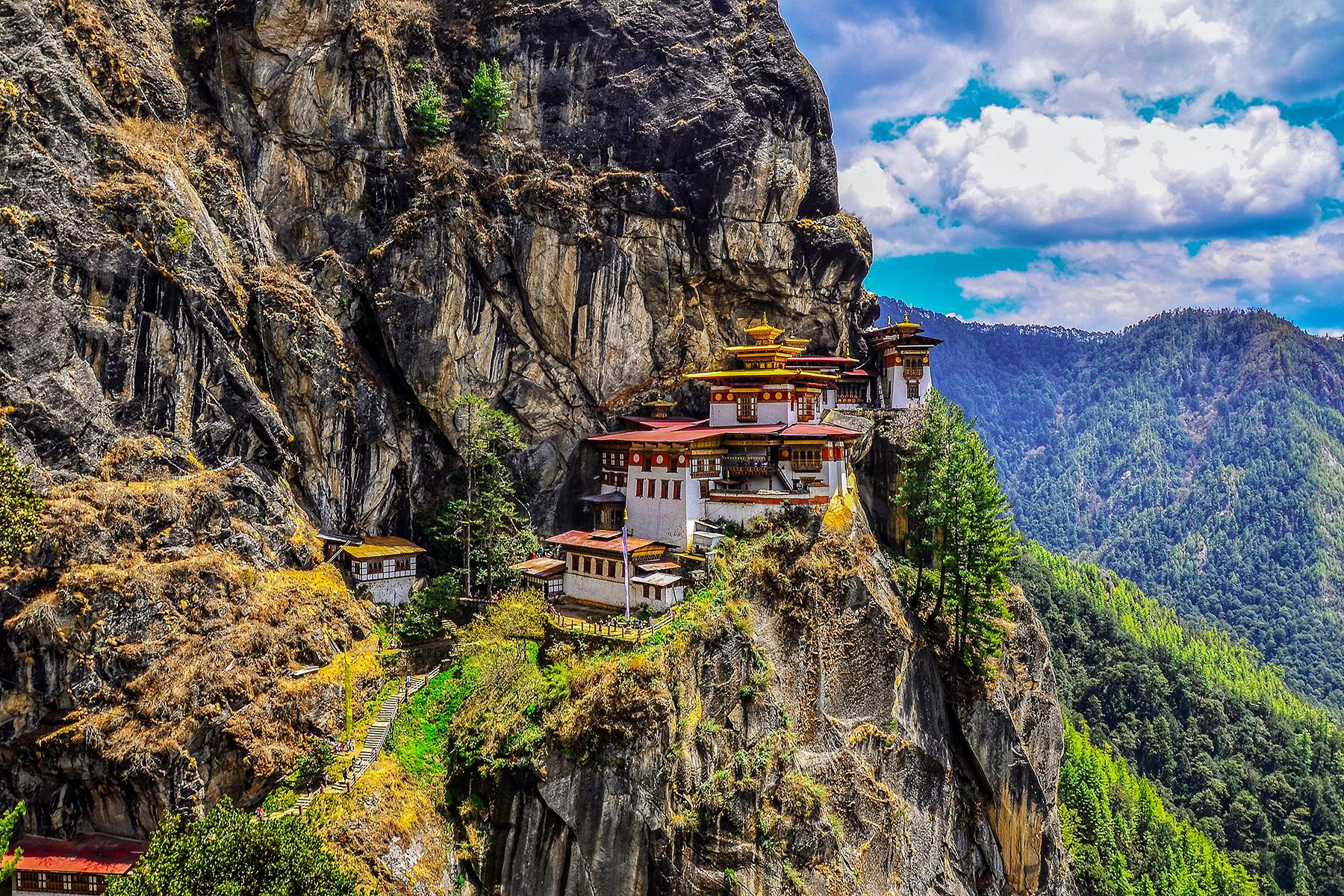
The next day, you hike to the legendary Tiger’s Nest Monastery, perched dramatically on a cliff. The 4-hour climb is your first real encounter with altitude – and your first quiet reminder to slow down, breathe, and respect the mountains.
Inside the monastery, cameras are not allowed. Just you, the silence, and the moment. It’s a powerful way to arrive – mentally as much as physically.
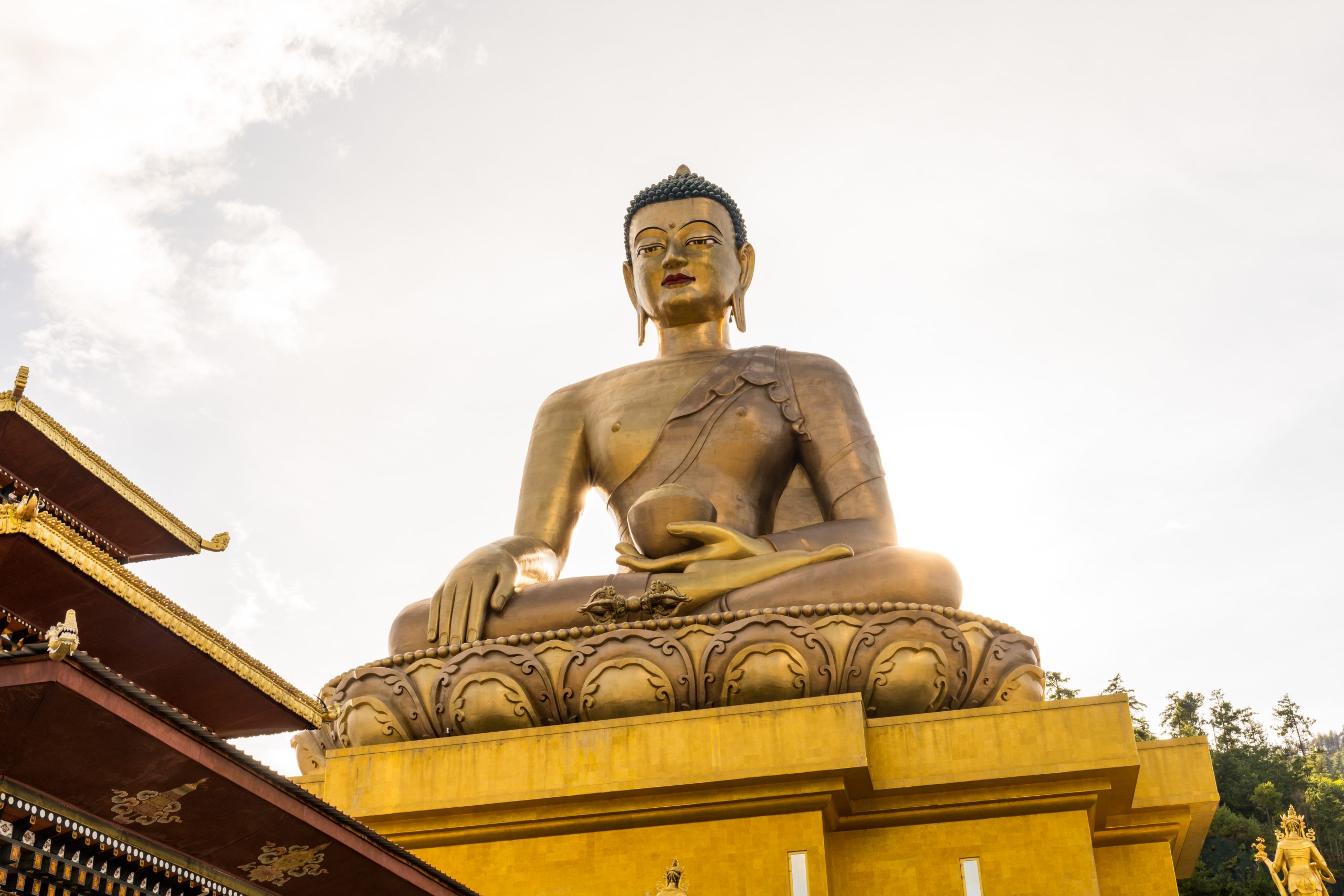
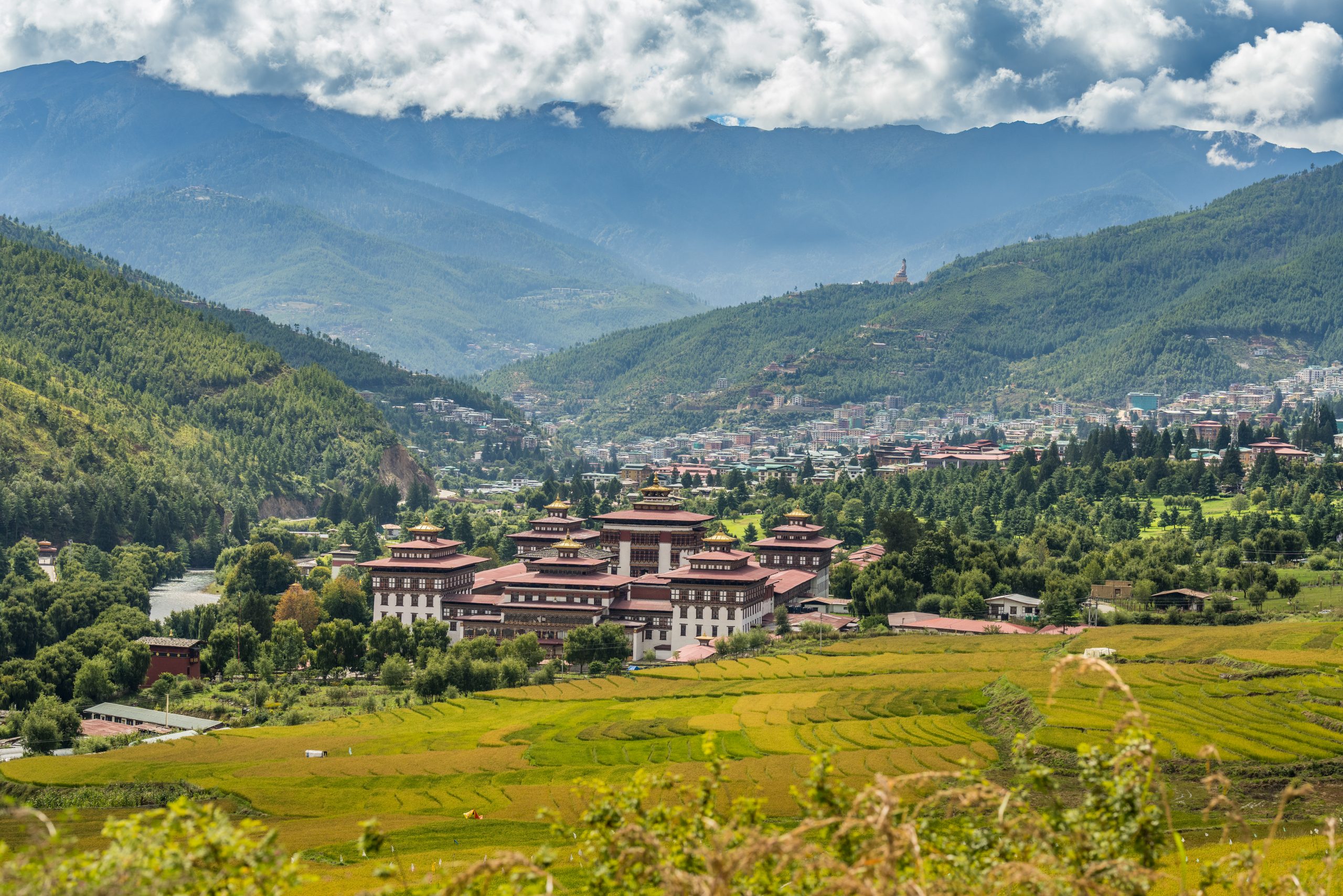
November 13th, Thimphu – the capital (2,320 m)
In Thimphu, you begin to find your rhythm. You’ll stand beneath the Buddha Dordenma statue which is 54 m tall and was built to celebrate the 60th anniversary of fourth king Jigme Singye Wangchuck. It houses over one hundred thousand smaller Buddha statues, each of which, like the Great Buddha Dordenma itself, are made of bronze and gilded in gold.
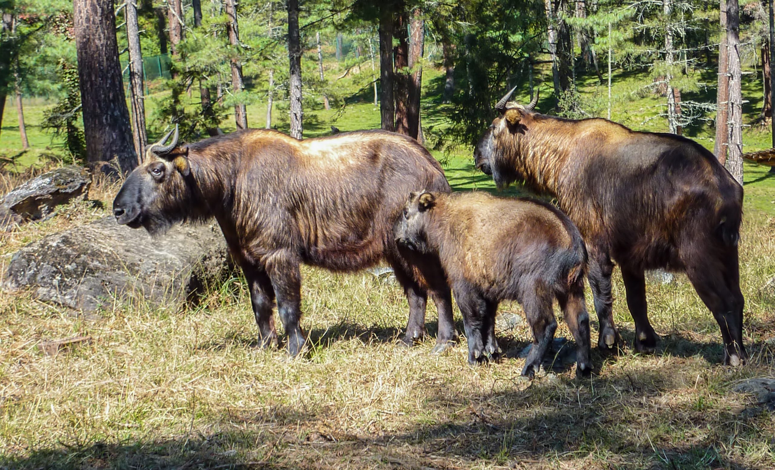
Then we visit the Motithang Takin Preserve on the eastern outskirts of Thimphu. This peaceful, forested reserve is home to Bhutan’s national animal – the takin (Budorcas), a rare and unusual species deeply rooted in the country’s culture.
Takins have been revered in Bhutan for centuries. According to legend, they were created by the Tibetan Buddhist master Drugpa Künleg, known as “The Divine Madman” for his unconventional teachings. Once kept in a small zoo, the animals were released after a king declared that keeping animals in captivity was not in line with Buddhist values. Having grown used to human care, they remained near Thimphu, often wandering in search of food. To protect them, the Motithang Takin Preserve was established.
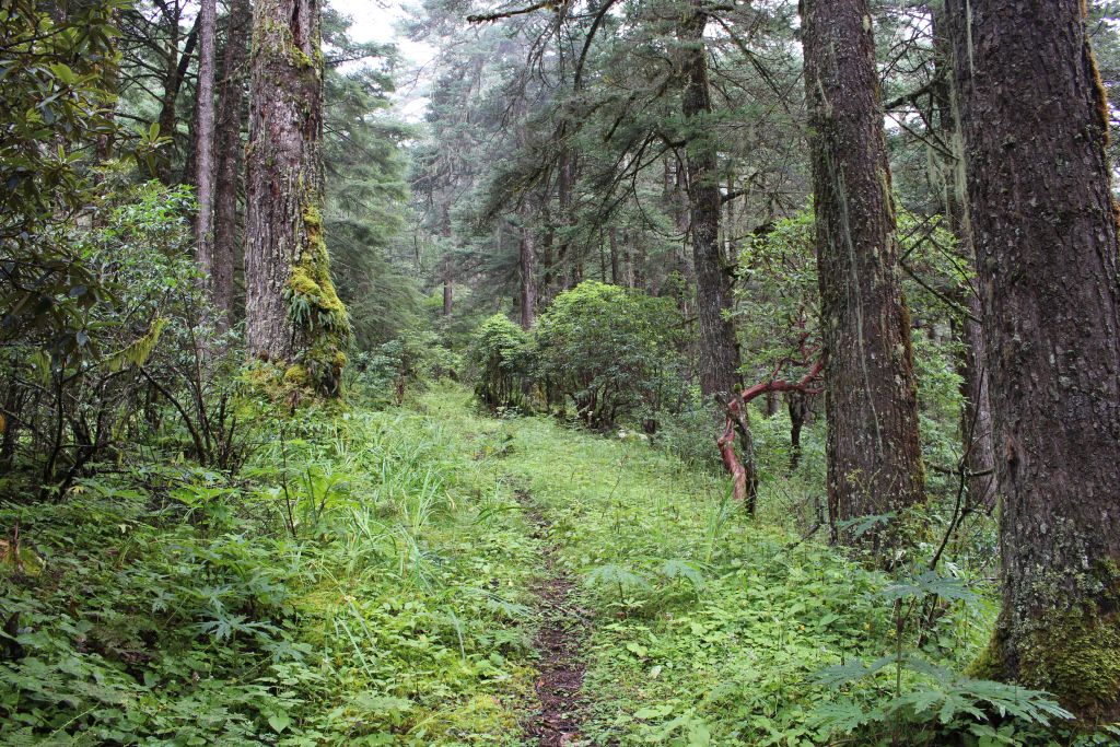
Later, an optional run or hike to Sangayang viewpoint (2,685 m) gives you your first chance to move fast at altitude. It’s not about racing – it’s about listening to your body.
November 14th, Thimphu to Punakha – moving through landscapes
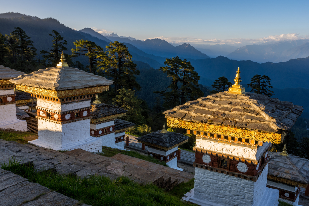
As you travel east, the scenery shifts dramatically. At Dochula Pass (3,116 m), we stop for a visit of the 108 chortens that rise there against the backdrop of the Himalayas – quiet and powerful.
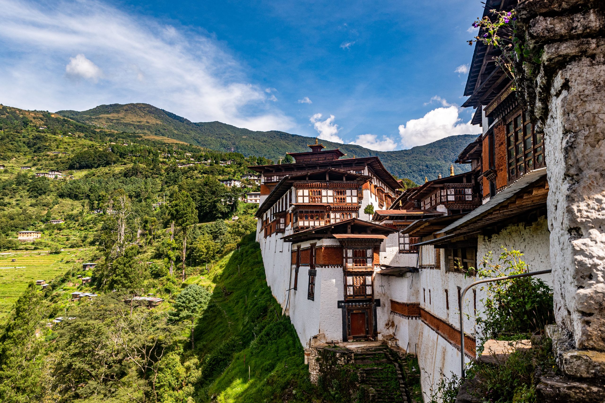
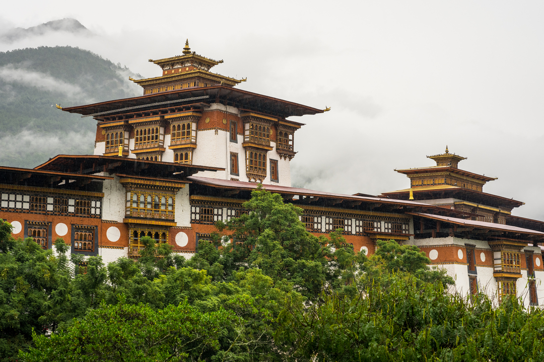
Afterwards, you’ll hike a 8 km section of the Trans Bhutan Trail (Thinleygang to Sew Drangsa) before descending into the lush Punakha valley, where you’ll explore the stunning Punakha Dzong (1,200 m). It is a Buddhist fortress-monastery and the administrative center of Punakha District. Built in 1637–1638 by Shabdrung Ngawang Namgyel, it is the country’s second oldest and second largest dzong, and one of its most impressive buildings. It served as Bhutan’s government seat until the capital moved to Thimphu in 1955.
November 15th, Phobjikha Valley – space to breathe
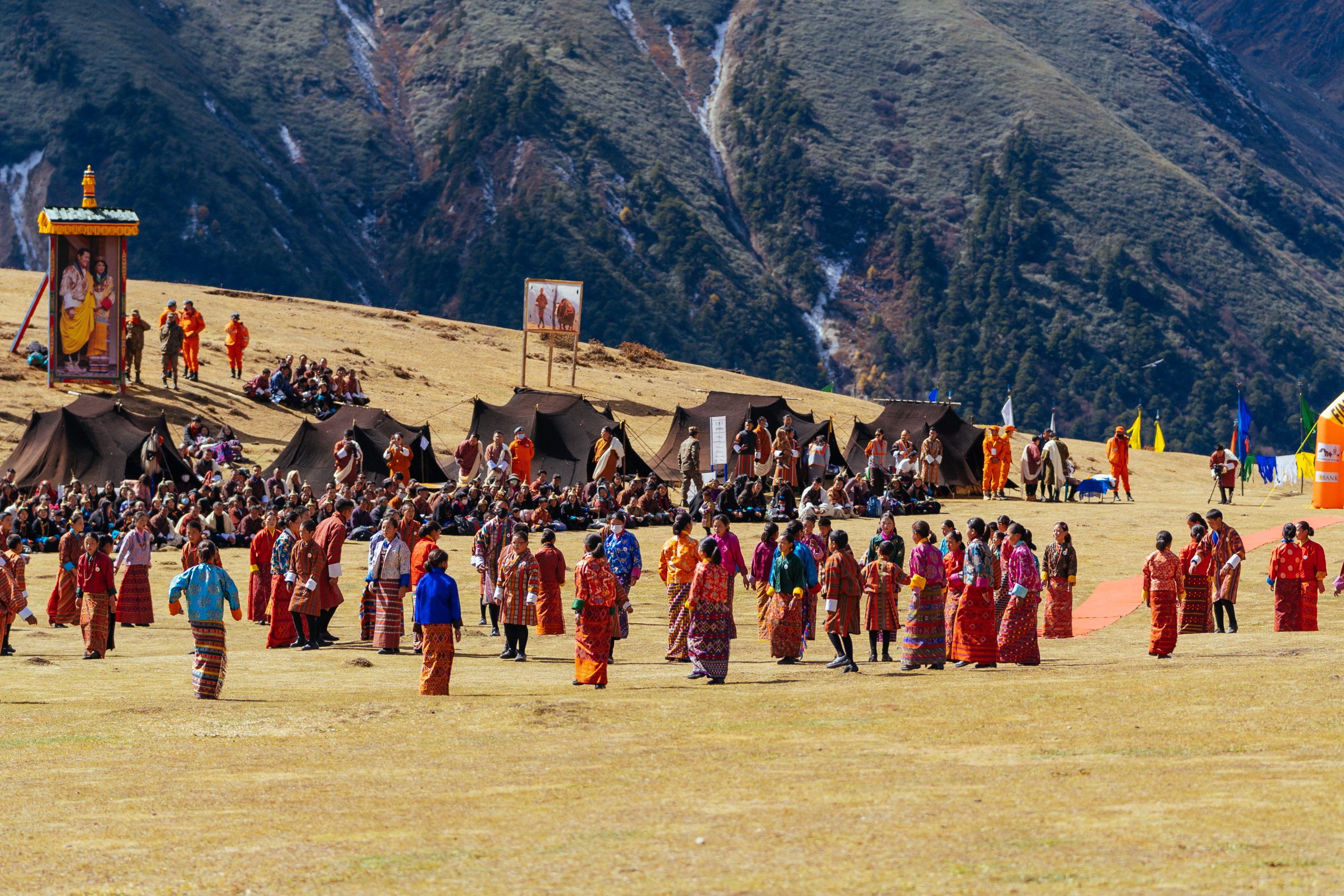
In the wide, glacial Phobjikha Valley (3,000 m), time seems to slow down. This is a place for quiet miles, easy movement, and deep breaths. If you’re lucky, you may even see the rare black-necked cranes that migrate here each winter.
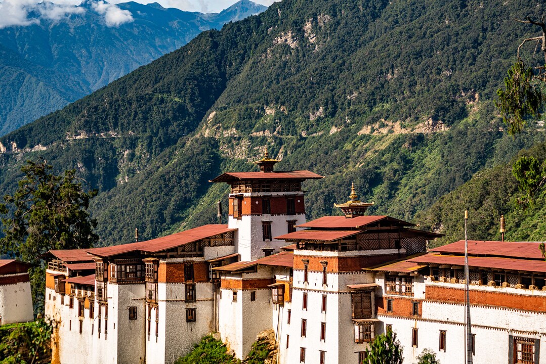
November 16th, journey to the start – Trongsa
The final approach takes you over Pele La Pass (3,423 m) and into more remote Bhutan. A hike to the ancient village of Rukubji (3,000 m) gives you a chance to feel ready.
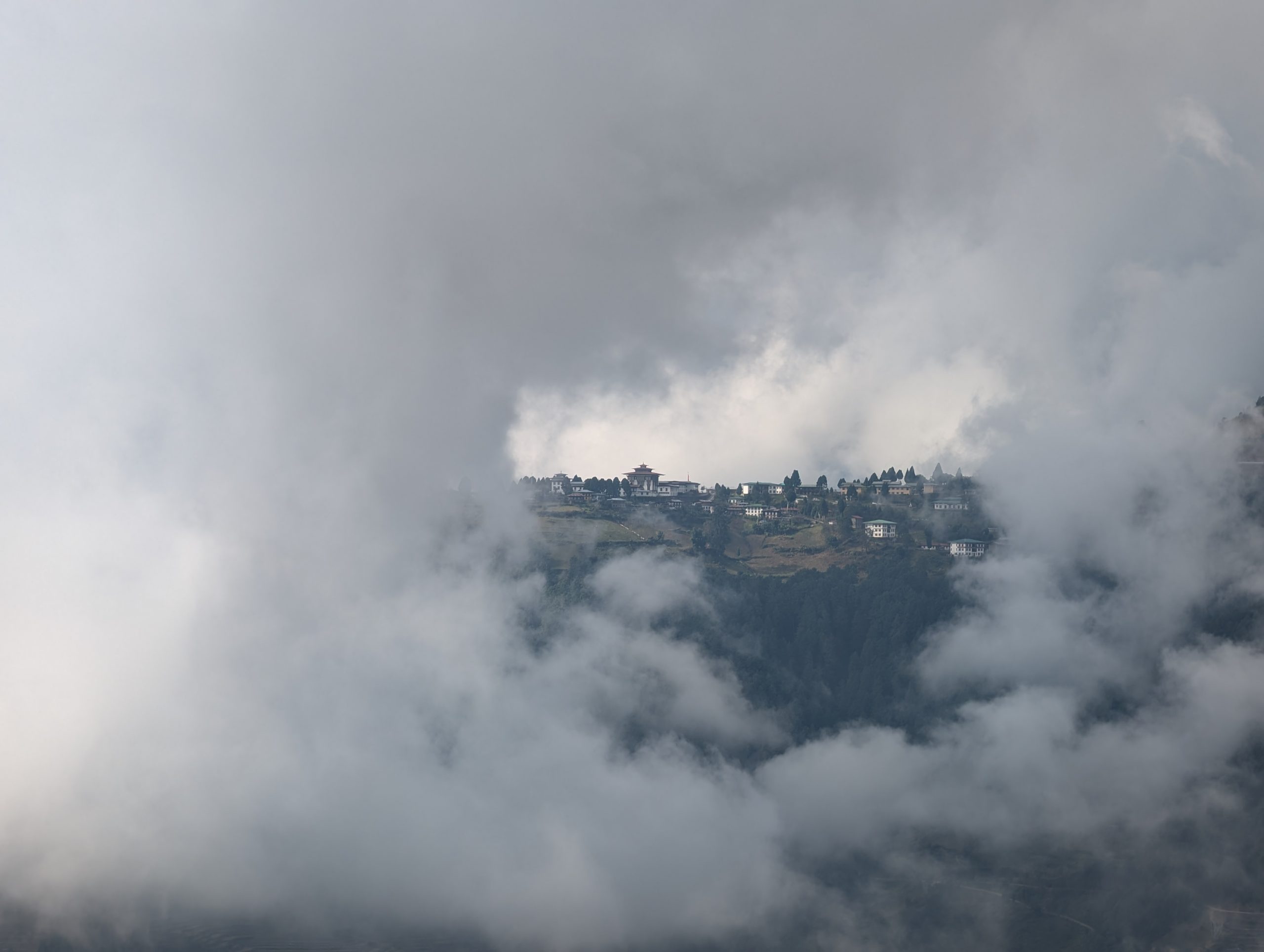
In the afternoon, we arrive in Trongsa and finish the day with the official gear check.
November 17th, the day before the race
After the race briefing, you’ll have time to rest, reflect, and explore the remarkable Trongsa Dzong – your start line.
The nerves will be there. But so will something else: calm, focus, and a deep sense that you’re exactly where you’re meant to be.
If you opted for the short itinerary, you will arrive in Bhutan on Nov. 14th. The next day you will also do the Hike to the Tiger’s Nest. Then, on the 16th, you will travel straight to Trongsa, with a stop at Dochula Pass on the way and Punakha Dzong on the way.